



Madrid’s Urban Evolution
Sueña Madrid > Madrid, a 360º city > Madrid’s Urban Evolution
How has Madrid evolved urbanistically?
Like cities everywhere in the world, Madrid has gone through a long process of growth and transformation over the years.
This is the story of its urban planning up to the current 1997 Plan:
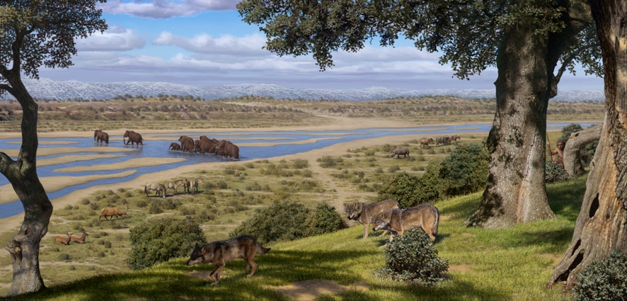
The Water Routes
It is worth remembering that the history of the city began long before the Madrid we know today existed. On the banks of the Manzanares River, its river terraces have offered water, fertile land and elevated places to live safely since prehistoric times. Over thousands of years, different human groups settled in this landscape, taking advantage of the river as a source of life and a natural route of connection. It was in this setting that, over time, the first settlements emerged that would eventually give rise to medieval Madrid, showing that the relationship between the city and its territory has always been essential to its development.
The Muslim Medina
Madrid originally began as an Arab settlement called Mayrit, around the year 850.
Mayrit was located on top of a hill because of its strategic position, and very close to a river. It had two clearly distinct urban areas: on one side, the fortress and the noble quarter.
On the other, the medina, made up of the two residential neighbourhoods that existed in the city at the time: one inhabited by Muslims and the other by Christians. The wall was a defensive enclosure for the city’s alcazar, or “medina”, and for the military citadel, or “almudayna”.


The Christian wall of Madrid
With a length of 2,200 metres and around 140 towers, the Christian wall was built to accommodate the new neighbourhoods that appeared after the Reconquest, once the town became part of the Crown of Castile.
From very early on, there was a population living outside the walls, which grew steadily throughout the 13th, 14th and 15th centuries, giving rise to what was known as the arrabal or outer suburb.
This area was uneven and scattered in form and was brought together around the churches outside the walls of San Martín, San Ginés and Santa Cruz.
Madrid, capital of the Kingdom
In 1561, Philip II decided to establish the capital of the kingdom in Madrid, a town that at the time had barely 15,000 inhabitants.
Once it became the seat of the court, this small city began to grow rapidly. New institutions flourished, such as convents and hospitals, which were located on the edges of the arrabal and outside the city.
Faced with this growth, Philip II ordered the construction of a new enclosure in 1566 for fiscal and health control, which included these neighbourhoods or settlements and led to the creation of new gates such as Puerta del Sol and Puerta de Atocha. The new enclosure had 8 gates and posterns and covered an area of 125 hectares.


The Royal Enclosure of Philip IV
The earlier enclosures, the Arrabal enclosure and that of Philip II, were no longer sufficient for a population that had tripled in the 17th century.
It became necessary to expand Madrid’s limits and build a new enclosure to replace the previous ones.
This new enclosure, known as the Enclosure of Philip IV or the Royal Enclosure of Philip IV, surrounded Madrid between 1625 and 1868. Its purpose was to control the movement of goods, ensure tax collection, and monitor who entered and left the city. Its main drawback was that it prevented the city from growing, forcing the population into overcrowded conditions for more than 200 years.
The capital city of the enlightened monarchy
The activity carried out by the monarchs who succeeded the House of Austria was extraordinary.
Urban changes and interventions followed one another quickly. The most notable began with the monumental Toledo Bridge, which solved the crossing of the Manzanares River to the south of the city. The Florida promenade, known as the Virgen del Puerto promenade, was also laid out, linking Segovia Bridge along the road to El Pardo. The fire at the Alcázar, and Philip V’s insistence on building the New Royal Palace on the same site, led to the area being defined as a noble zone.
Madrid had a green belt that included Buen Retiro, Paseo de los Olmos, Paseo de los Pontones, Paseo de las Acacias, the Manzanares Canal, and others.

Castro’s Expansion Plan
Around 1860, Madrid experienced its first major growth phase, when the bourgeoisie succeeded in demolishing Philip IV’s enclosure thanks to the Castro Plan.
Carlos María de Castro was one of the urban planners who promoted an orderly growth model for the city, based on the separation of neighbourhoods through the development of the ensanches or expansion areas.
The implementation of the Castro Plan defined the city’s first ring road, also known as M-10, enclosing the area that is now considered Madrid’s historic centre.
Beyond this boundary, the outskirts expanded rapidly and the development of the ensanche was uneven and irregular in the late 19th century. Neighbourhoods such as Tetuán, Prosperidad and Guindalera grew, while new railway and industrial facilities developed quickly between the historic centre and the Manzanares River.
The General Expansion Plans and the Besteiro Plan (1933)
The city continued to grow steadily throughout the 20th century. Madrid was becoming a metropolis that was outgrowing the limits of the ensanche designed by engineer Carlos María de Castro, which made comprehensive city-wide planning necessary.
Between 1923 and 1926, the General Expansion Plans were drawn up in response to the problems created by uncontrolled peripheral growth, driven by construction and population increase.
In 1933, the Extension Plan for the Municipality of Madrid, known as the Besteiro Plan, was approved. It proposed the annexation of surrounding municipalities and supported a new axis of city growth along the Castellana. However, this plan was interrupted by the Civil War.
The Bigador Plan (1946)
Reconstruction shaped Madrid in the early 1940s, as much of the city’s built fabric, as well as entire municipalities, had been destroyed or damaged by the war.
It was not until 1946 that the General Urban Plan of Madrid was approved, known as the Bigador Plan, after urban planner Pedro Bigador Lasarte. At that time, some of the surrounding municipalities were annexed to Madrid. The plan addressed the major north-south axis, green rings, the Nuevos Ministerios complex and the incorporation of peripheral municipalities.

Development-era Madrid
A new wave of migration to the capital meant that, by 1960, Madrid had passed the two-million-inhabitant mark. This growth spread across the entire province, especially in the metropolitan ring.
By 1961, the urbanised area covered 10,465 hectares, and Madrid had several different “Madrid”: one residential area in the north, with luxury housing; another with acceptable construction and urban quality aimed at the middle classes, such as the neighbourhoods of El Pilar, La Concepción and Moratalaz.
At the same time, urban expansion led to a new peripheral belt of state-built housing estates, private developments for working-class families, planned settlements and informal shanty towns, such as Pozo del Tío Raimundo, Palomeras, La Alegría, La Celsa and La China.
The 1963 Metropolitan Area General Plan
The General Plan for the Madrid Metropolitan Area, drafted in 1961 and finally approved in 1963, tried to adapt to the new reality created by chaotic growth driven by speculation.
This plan created the Madrid Metropolitan Area, incorporating 23 municipalities, and established two major zones: one for industrial decentralisation in the south and east, and another for residential use and leisure in the northwest.
In the 20 years between the plan’s approval and 1983, the year the Community of Madrid was created with the approval of its Statute of Autonomy, Madrid took shape as a metropolitan region organised around the capital.

The 1985 General Urban Development Plan
The Madrid City Council decided to review the planning framework and created the Municipal Planning Office to draw up a new urban plan for Madrid. The new projects set out two main goals: to organise the city and equip it with better infrastructure.
The new General Urban Development Plan of 1985 focused on improving transport infrastructure, encouraging public transport and adapting the transport system to the European Community framework; supporting housing policies; protecting historical and artistic heritage; promoting environmental policy; and addressing congestion and pollution problems.
This 1985 plan was revised in 1995 and replaced by the General Urban Development Plan of Madrid (PGOUM), approved in 1997.
The 1997 General Urban Development Plan (PGOUM)
Madrid’s current General Urban Development Plan (PGOUM 1997) is now 29 years old. It was drafted by a large municipal technical team led by Luis Rodríguez-Avial, who carried out a review of the 1995 plan. It officially came into force when it was approved in 1997.
Today, the Office of the New General Plan is in the process of reviewing the urban planning system in order to produce a new instrument that will define the city’s model for the years ahead.
The 1997 plan offered a structured vision for Madrid’s future development, bringing together projects already underway and new strategic proposals.
First, it took on the residential developments planned under the Urban Action Programmes (PAUs), which shaped the city’s expansion. It also needed to accommodate the major airport city of Barajas, whose growth required a coherent territorial integration.
The plan also proposed creating a new major green lung in the east, now known as Valdebebas, conceived almost as a second Casa de Campo on the other side of the city. Alongside it, a centrality area was designed in Canillejas to strengthen the city’s urban balance.
Other major projects included the extension of the Paseo de la Castellana, known as the Chamartín Operation, and the layout of an urban axis to the south that would act as both a symbolic and functional continuation of that great north-south corridor. The Campamento Operation was also integrated, and the regeneration of the Méndez Álvaro area was promoted, designed as a new central hub to reinforce the metropolitan structure.
What do we want future Madrid to be like, and how will we get there?
Planning the Madrid of the future, while taking its history and identity as a reference, and doing so across all scales — neighbourhoods, the global city and even the metropolitan area — requires new legal and digital tools, as well as a different way of planning: more agile and more integrated, because the city is a complex system.
Understanding how to plan the city of the future requires a new regulatory framework that is more agile and simplified, but still provides legal certainty, takes a strategic and metropolitan approach, regulates what truly matters, incorporates digitalisation and data as planning tools, and leaves room for adaptation. It also requires innovative digital instruments: using technology to base planning on real, up-to-date data; establishing dynamic and relational indicators to assess the balances that need to be achieved; simulating different scenarios; and supporting decision-making in strategic planning that does not impose specific solutions or tools, but instead sets measurable goals and remains adaptive and dynamic enough to respond to changing scenarios. For any planner working on a city like Madrid, this is now essential.
The new Municipal Strategic Plan will be a new planning instrument that will not only respond to the city’s needs, but, from its very first draft and throughout the entire process of strategy design and development, will also seek to involve society as a whole.
In this way, the Municipal Strategic Plan will be based on a real, current and specific understanding of the people who live in Madrid, helping to shape a better version of the city.
Queremos que tú también sueñes Madrid
Si eres ciudadano, empresa o institución y tú también imaginas un Madrid mejor, queremos conocer tu propuesta.


